

NHAZCA proprietary technology
PhotoMonitoring™ is a remote-sensing technique for the continuous, precise monitoring of surface displacements, deformations and significant changes across the observed scene. Images from ground-based cameras — fixed in place or precisely repositioned at each survey — are automatically aligned, correlated and compared using Digital Image Correlation and change detection algorithms, reaching an accuracy finer than the pixel size of the image (sub-pixel).
It is the optical technology that works inside NHAZCA's monitoring services — landslides, bridges, dams, tunnels, geotechnical and structural assets — with all data processed in IRIS, NHAZCA's proprietary platform.
Chosen by infrastructure operators, public bodies and engineering firms across Europe


The technique
From pictures to measurements: PhotoMonitoring turns sequences of photographs of the same scene into displacement maps, time series and change maps. It is not visual surveillance — every pixel becomes a potential measurement point.
1
Cameras in fixed positions — or precisely repositioned at each survey — capture images of the scene, even from kilometres away, with automatic data transfer and full remote management over 4G/5G or Wi-Fi. Acquisition rates go up to one image every 10 seconds.
2
Algorithms align the images with pixel-accurate precision and normalise illumination differences between acquisitions: clouds, shadows and exposure changes do not turn into false movements.
3
Digital Image Correlation measures displacements by comparing image pairs over short and long baselines (multi-baseline analysis); change detection identifies what has changed in the scene. Accuracy is sub-pixel: finer than the pixel size of the image.
4
Every detection receives a confidence score, cutting false positives compared with plain motion detection; critical alerts can be routed through human review before notification. The output: full-field displacement maps, time series for points and areas, and change maps ready for early warning workflows.
The technique works in daylight and good visibility, and can be extended to night-time operation with suitable lighting systems. Measurements capture movement components in the image plane, orthogonal to the line of sight, and can be correlated with rainfall, earthquakes, construction activity and other external drivers.
Applications
Convergence measurement during excavation and in service, with no physical targets on the lining. The measurement follows the deformation of the section at the pace of the works, not at the pace of survey campaigns.
Automatic rockfall detection and mapping from a fixed observation point: every detachment is counted, measured and archived, building distribution and frequency maps for quantitative hazard assessment.
The full-field view of a moving slope: displacement maps and time series on active landslides, supporting the decisions of authorities and asset owners.
Applications · Tunnels
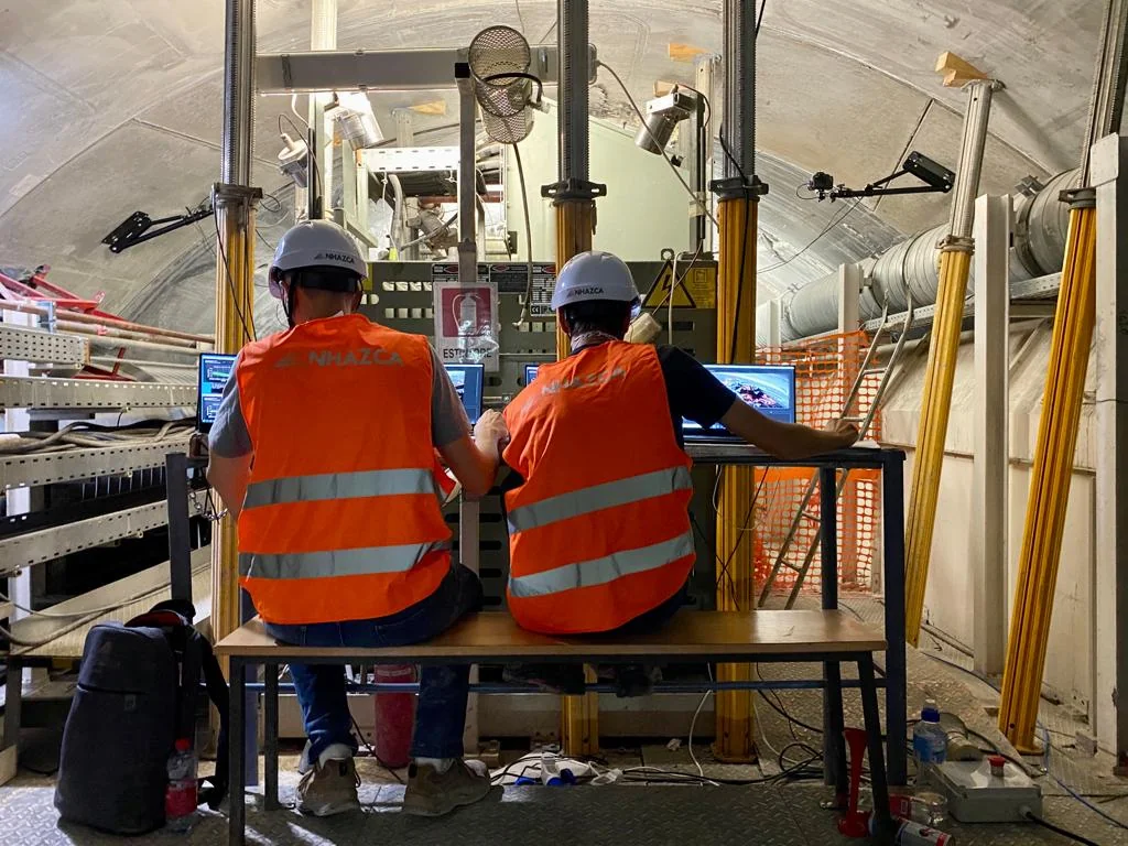
PhotoMonitoring measures the convergences of existing tunnels and tunnels under construction with no physical targets to install on the lining: no optical targets glued to the lining, no interference with the works. The same configuration follows the tunnel from excavation into service.
By periodically acquiring images from one or more observation points, displacements of the tunnel intrados are measured over time with a temporal approach (displacement time series at any visible point in the image) and a spatial approach (full-field displacement maps that reconstruct the overall deformation field of the section). Images can come from high-resolution industrial devices with automatic data transfer, mounted on poles or on existing structures.
Benefits
No physical targets
No targets or other objects need to be installed in the monitored scene: the measurement is contactless.
Comprehensive spatial data
From the point data of conventional surveying to spatial data: a detailed, complete picture of the deformation of the section.
Remote management
The automated, configurable system can be fully managed remotely.
Applications · Rock walls
From a fixed observation point, PhotoMonitoring identifies, counts and maps detachments from the rock face, even small ones: each event is detected by automatically comparing successive images, measured in area and position, and archived with its before/after evidence. The result is a rockfall counter with distribution and frequency maps that pinpoint the most susceptible portions of the slope — the quantitative basis for hazard assessment and for sizing preventive or protective measures along railways and roads exposed to rockfall, and on quarry and mine faces.
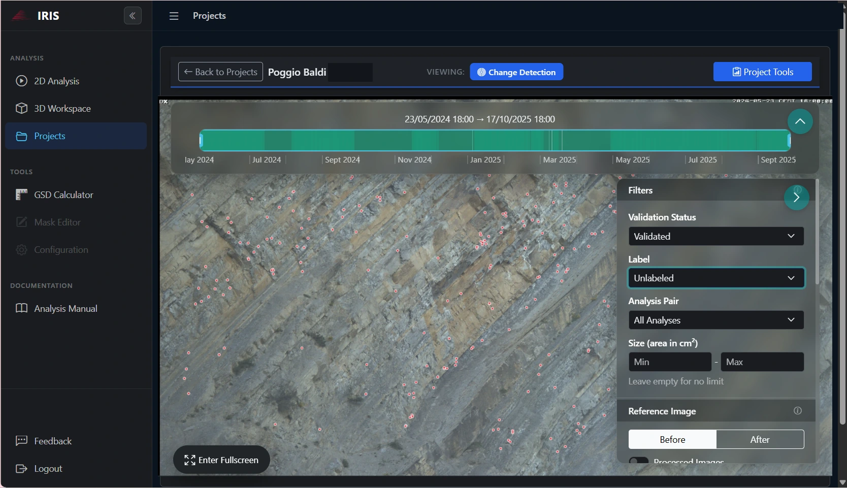
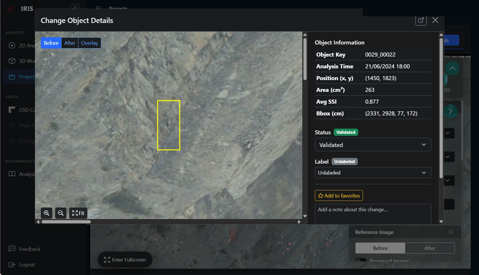
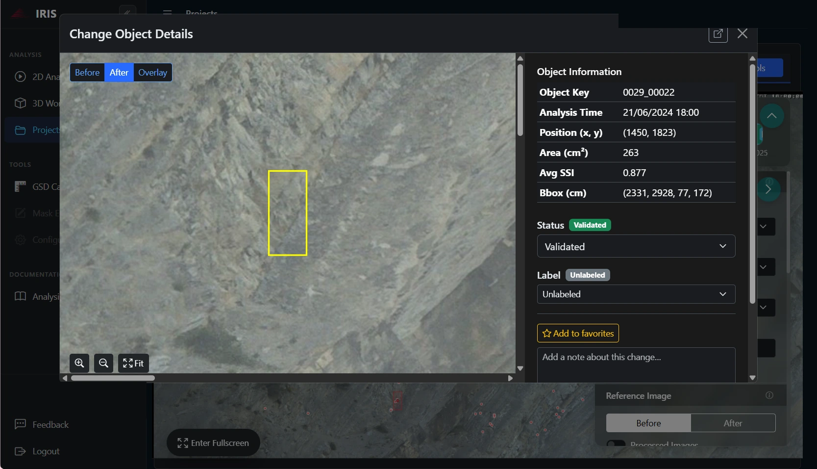
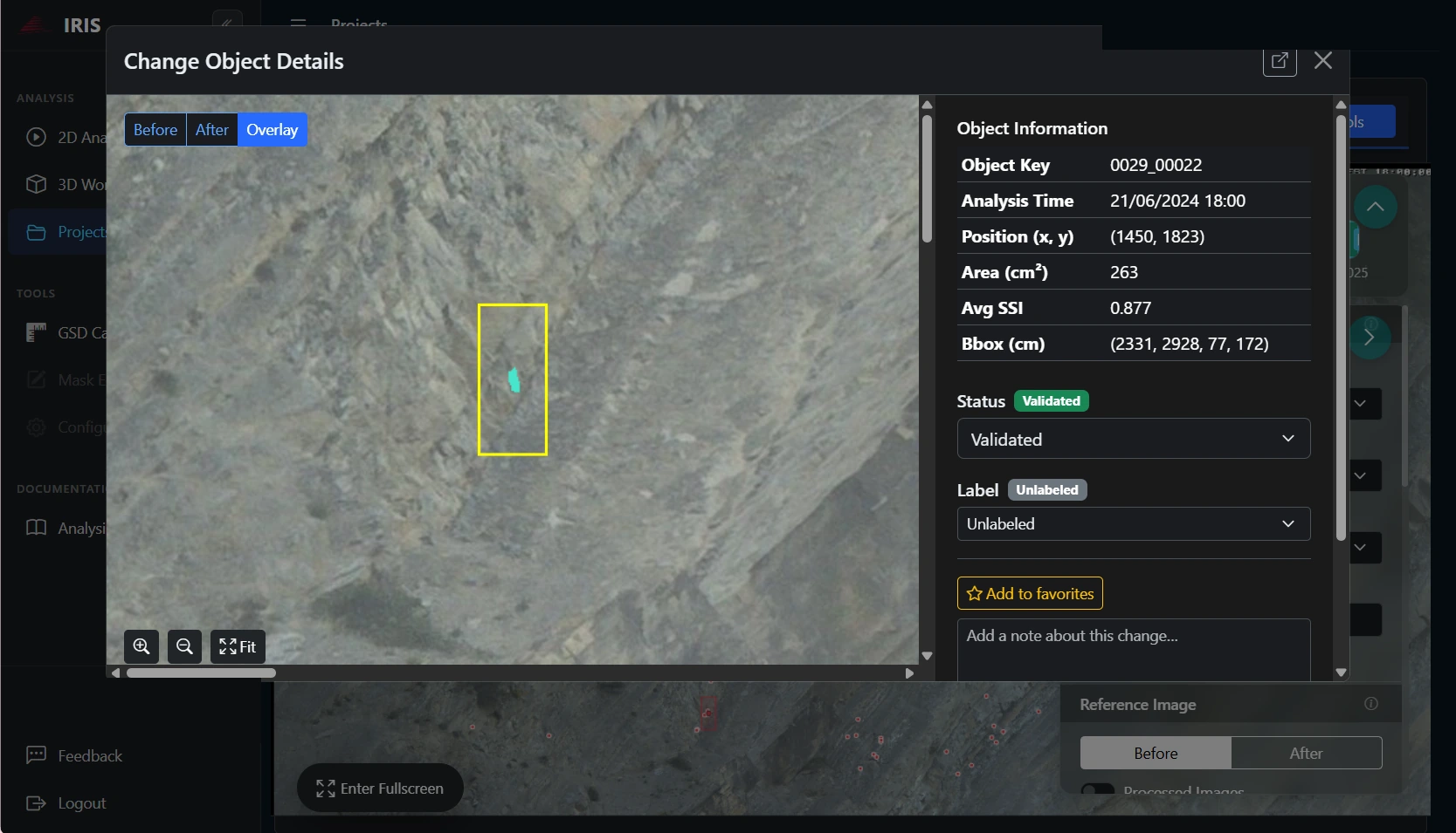
A single detachment detected automatically: before/after comparison and highlighted change, with measured area and position.
Methodology published in the peer-reviewed literature (Mastrantoni et al., 2024).
Benefits
Zero physical targets
No need to install targets or other objects in the study scenario.
Change maps
The system computes change maps of the visible portions of the rock face, moving from point data to spatial data.
Fixed observation point
A fixed observation point removes the uncertainty caused by repositioning the instrument between acquisitions, and the system can be fully managed remotely.
Applications · Slopes
Cameras in strategic positions, at one or more observation points, follow the slope with multiple updates per day: PhotoMonitoring delineates moving areas, measures their displacement rates and produces change maps of the visible portions of the slope, with nothing installed on the ground. It is a non-invasive method that returns a timely, detailed assessment of ground changes — including on phenomena with very rapid, impulsive evolution; time series make it possible to correlate accelerations with rainfall, earthquakes and other external drivers.
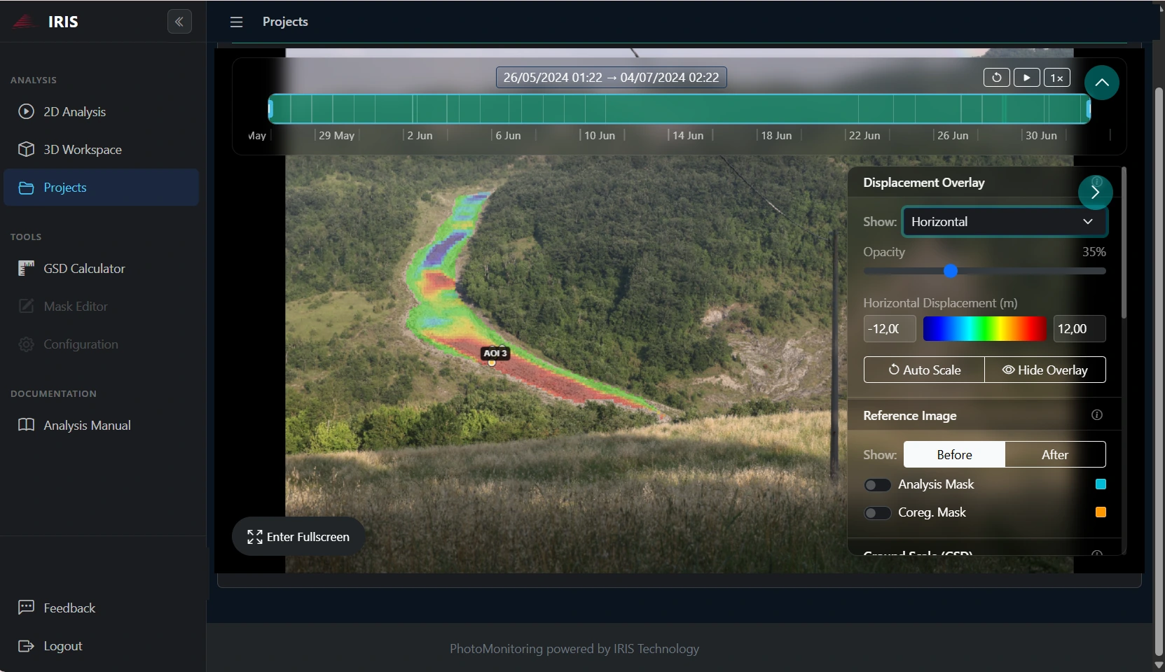
Horizontal displacement map of a moving slope: colours measure movement, point by point.
Benefits
Detailed maps
Change maps of the visible portions of the slope or escarpment: from point data to spatial data.
Adjustable acquisition frequency
Image acquisition frequency can be increased or reduced according to weather conditions and to how fast the phenomenon evolves.
Decision support
Maps and time series support the decisions of authorities and asset owners, who can adopt risk mitigation measures and protect vulnerable areas.
The platform
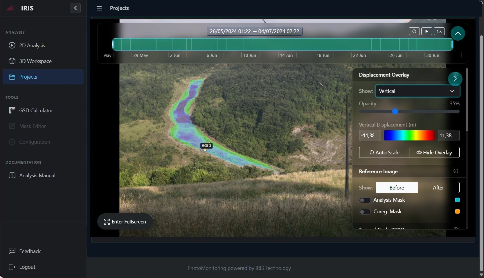
Images and measurements are processed in IRIS, the proprietary software designed and developed by NHAZCA for geomorphological, geotechnical and structural monitoring, in its Terrestrial, Aerial and Satellite configurations. Processing runs on the platform's servers: no software to install, no desktop licences, no dedicated workstation.
IRIS Terrestrial processes images from ground-based cameras to measure surface displacements and changes on landslides, rock faces, structures and tunnels. IRIS Aerial works on drone imagery, for repeated surveys in hard-to-reach areas. IRIS Satellite analyses panchromatic and hyperspectral satellite imagery to track changes of the Earth's surface over wide areas and long time spans, supporting monitoring plans and engineering projects.
IRIS ingests images from virtually any source:
And it returns results built for decisions and for technical scrutiny:
For repeated surveys, IRIS also compares 3D point clouds directly in the browser using the M3C2 algorithm, the reference standard for point cloud comparison: volumetric change maps between two epochs, automatic clustering of changed areas, volume and surface computation, and a 3D viewer you can share with a link.
Three ways to start: connect the cameras already on site, stream images from remote stations, or opt for full-service installation with NHAZCA field engineers, from station design to commissioning.
To size camera and monitoring distance, a free GSD Calculator is available on the IRIS platform.
The CARE system
Not every scene justifies a permanent installation. The CARE system, developed by NHAZCA, enables precise repositioning of the sensor at every survey: the camera returns to exactly the same shooting position, reducing processing errors caused by framing changes, and images from different campaigns become comparable as if they came from a fixed station. It works with any camera — smartphones included — making periodic surveys possible even where a fixed system is impractical or disproportionate to the risk.
The NHAZCA approach
Inclinometers, extensometers and total stations measure single points with great precision. PhotoMonitoring measures the whole framed scene: every pixel is a potential measurement point, and spatial coverage is continuous. The two families of instruments do not replace each other — they complement each other.
That is why the technique is integrated into NHAZCA monitoring systems alongside geotechnical instrumentation and satellite and terrestrial InSAR: continuous image coverage shows where to look, point-based instruments guard the known critical spots.
Inside NHAZCA services
PhotoMonitoring works inside NHAZCA's services for landslide, bridge, dam, geotechnical and structural monitoring, alongside the other technologies of the suite: InSAR interferometry and the SGAM asset management platform.
Case studies
Benefits
Quantitative measurements, not impressions: sub-pixel accuracy, a confidence score on every detection and optional human review on critical alerts. Measurements of surface displacements and changes you can base stability assessments and targeted interventions on — with fewer false positives.
From industrial cameras to a smartphone with the CARE system, from a single rock face to continuous multi-site monitoring, from natural hazard management to civil engineering and land use planning: the same technology adapts to the scene, the distance and the level of risk.
Every event stays documented: downloadable before/after comparisons, a searchable audit trail and complete historical series. When you need to prove what happened and when, the evidence is there.
Further reading
Mastrantoni et al. (2024) — Automatic photomonitoring analysis for spatiotemporal evaluation of rockfall failure hazard
Engineering Geology, vol. 339, art. 107662: automatic analysis with the IRIS software on the Poggio Baldi rock face, 395 days of observation. The reference cited for rockfall detection and mapping.
Brunetti, Cosentino, Mazzanti (2022) — PhotoMonitoring: digital photography as a monitoring tool (Ingenio, in Italian)
Our technical article on Ingenio (in Italian), 13 October 2022: change detection, Digital Image Correlation and the IRIS software.
Sapienza University of Rome — Poggio Baldi Natural Laboratory
Institutional page (in Italian) of the natural laboratory on the Poggio Baldi landslide, supported by NHAZCA: the test site of the rockfall detection and mapping images.
Sapienza University of Rome (2021) — Poggio Baldi landslide: opening of the experimental monitoring site
Institutional news (in Italian), 26 October 2021, on the opening of the test site, with NHAZCA among the partners.
ESA Space Solutions — Smart-GAM
ESA Business Applications project (2021–2022) with NHAZCA as prime contractor: decision support for geotechnical assets with A-DInSAR and PhotoMonitoring.
FAQ
What is PhotoMonitoring?
PhotoMonitoring is a remote-sensing technique that measures displacements, deformations and changes in a scene by comparing photographic images acquired over time, using Digital Image Correlation and change detection algorithms. NHAZCA applies it to the monitoring of landslides, rock faces, tunnels, dams, bridges and construction sites.
How accurate is PhotoMonitoring?
Accuracy is sub-pixel: finer than the pixel size of the image. The real-world resolution depends on distance and optics — typically from a few millimetres to a few centimetres — and is engineered when the camera station is designed.
Which cameras can be used?
High-resolution industrial systems with automatic data transfer, but also IP cameras already on site, DSLR time-lapse rigs and webcams: the IRIS platform ingests video streams, snapshots and archives. With the CARE system, periodic surveys can be carried out with any camera, smartphones included.
Does PhotoMonitoring work at night or in bad weather?
The technique works in daylight and good visibility; operations can be extended to night-time with suitable lighting systems. Dense fog or an obstructed view suspend the measurement: for continuous coverage in all conditions it is combined with radar techniques such as InSAR, which NHAZCA deploys alongside the cameras in the same monitoring systems.
Does PhotoMonitoring replace inclinometers and extensometers?
No — it complements them. Point-based instruments guard known critical points with great precision; PhotoMonitoring continuously covers the whole framed scene and shows where movement is happening, multiplying measurement points without multiplying installed sensors.
How does camera-based rockfall detection work?
Successive images of the rock face are automatically compared: each detachment is detected as a change, measured in area and position, validated with a confidence score and archived with its before/after evidence. Over time this builds a rockfall counter with distribution and frequency maps, feeding quantitative hazard assessment and early warning procedures.
Let's talk
From station feasibility to monitoring in service: tell us about the phenomenon you need to observe and we will propose the right PhotoMonitoring configuration.